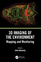
3D Imaging of the Environment
Mapping and Monitoring
| dc.contributor.editor | Meneely, John | |
| dc.date.accessioned | 2025-03-07T20:27:12Z | |
| dc.date.available | 2025-03-07T20:27:12Z | |
| dc.date.issued | 2024 | |
| dc.date.submitted | 2023-09-14T08:07:48Z | |
| dc.identifier | OCN: 1393220607 | |
| dc.identifier | https://library.oapen.org/handle/20.500.12657/76327 | |
| dc.identifier.uri | https://doab-dev.siscern.org/handle/20.500.12854/165687 | |
| dc.description.abstract | This book gives readers detailed explanations of the techniques used to map and monitor the built and natural environment and how that data, collected from a wide range of scales and cost options, is translated into an image or visual experience. It is written with technical, professional, and academic readers in mind. | |
| dc.language | English | |
| dc.rights | open access | |
| dc.subject.other | Drones, Remote Sensing, Visualization, 3d, 4d, VR, AR | |
| dc.title | 3D Imaging of the Environment | |
| dc.title.alternative | Mapping and Monitoring | |
| dc.type | book | |
| oapen.identifier.doi | 10.1201/9780429327575 | |
| oapen.relation.isPublishedBy | fa69b019-f4ee-4979-8d42-c6b6c476b5f0 | |
| oapen.relation.hasChapter | Chapter 9 CHERISH | |
| oapen.relation.isbn | 9780367337933 | |
| oapen.relation.isbn | 9781032108957 | |
| oapen.relation.isbn | 9780429327575 | |
| oapen.imprint | CRC Press | |
| oapen.pages | 246 | |
| peerreview.review.type | Proposal | |
| peerreview.anonymity | Single-anonymised | |
| peerreview.reviewer.type | Internal editor | |
| peerreview.reviewer.type | External peer reviewer | |
| peerreview.review.stage | Pre-publication | |
| peerreview.open.review | No | |
| peerreview.publish.responsibility | Publisher | |
| peerreview.id | bc80075c-96cc-4740-a9f3-a234bc2598f1 | |
| peerreview.title | Proposal review |
Fichier(s) constituant ce document
| Fichiers | Taille | Format | Vue |
|---|---|---|---|
|
Il n'y a pas de fichiers associés à ce document. |
|||
Ce document figure dans la(les) collection(s) suivante(s)
Chapters in this book
-
(2024)Ireland and Wales have a combined coastline of approximately 9,000 km in length, comprised of a combination of rock and soft sediment. Many archaeological and historical sites along this coastline are at risk of being ...